Looking for public domain maps?
Here are 21 great sources.
Libraries are a natural starting point in any search for public domain maps, especially university libraries and large public libraries (go to the reference section and ask). But if you’re looking for public domain maps online ... here's a list to get you going.
Note: For each site offering public domain maps listed below, I tell you what you’ll find and what each site’s fine print says. (You know, the stuff nobody wants to read.) What fine print? you ask. Aren’t these public domain maps? Yep. But listen ...
Some sites have a mix of public domain and copyrighted items. Not only that, but sometimes owners of public domain materials place use restrictions on copies. Not that they should ... or even that they can, legally speaking. But it helps if you know what you’re dealing with. Most often, though, all that’s asked of you is that you credit the source of the map. So I’ve made sure to include any requested credits. (Crediting is the right thing to do. But you knew that already.)
Public domain maps: resources list
- American FactFinder | US Census Bureau
-
What’s there: Customizable, printable, and download reference (geographic boundaries) and thematic (statistical data) maps based on the 2000 population census (the most recent decennial census) and other surveys. You can download maps and legends as GIFs or PDFs. You can also download map data in Microsoft Excel (.xls) format or in a comma-delimited text file that can be imported into many desktop applications. The site includes a nice tutorial on creating and using maps.
Using the maps: With rare exceptions, US Census Bureau materials are entirely in the public domain. (Items that include copyrighted material indicate what is copyrighted.) The Census Bureau does ask that you cite it as the source of any material you republish, however.
- Bureau of Land Management | Public Lands Information Center (PLIC) Map Center
-
What’s there: Topographic maps of 12 states in the western US (Alaska, Arizona, California, Colorado, Idaho, Montana, New Mexico, Nevada, Oregon, Utah, Washington, and Wyoming). Maps may be ordered online (prices are reasonable). The site states that you may also download PDF versions of the maps, but I wasn't able to. Another way to get maps is to order them directly from the various BLM state offices (links to them are at the top of the FAQ page on the main BLM site).
Using the maps: Maps prepared by the Bureau of Land Management, a US federal agency, are in the public domain. Appropriate credit is requested.
- CIA World Factbook
-
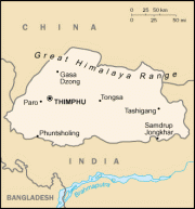
Map of Bhutan, 2005. (The World Factbook)
What’s there: World maps, individual country maps, and regional maps prepared by the US Central Intelligence Agency for the use of US government officials. The Factbook is currently updated every two weeks. Reference maps are available in JPG and PDF format, and the individual country maps are available in GIF format.
Using the maps: The Factbook is in the public domain, making the maps in it public domain maps. They may be copied freely, but you’re asked to cite The World Factbook as the source. Note, too, that the official seal of the CIA may not be copied without permission. Misuse of the official seal of the CIA could result in civil and criminal penalties ... so don’t do it.
- John R. Borchert Map Library | University of Minnesota
-
What’s there: Directory of map libraries and organizations in the US, Canada, Europe, Asia, and Australia. Lots of links to explore here. When I last checked, though, some of the links resulted in 404 (page not found) errors ... but there’s still a ton of info here.
Using the maps: Your use of any maps you find through this directory will depend on restrictions, if any, and/or license terms imposed by the organizations that own the originals. (Sorry — I don’t have time to read the terms and conditions of every site in a directory. ;)
- Library of Congress: Geography and Map Division
-
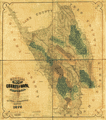
Map of Napa County, 1878. Geography & Map Division,
Library of Congress.What’s there: With one of the largest and most comprehensive map collections in the world, the Library of Congress is a great source of public domain maps. While the online map collections are a relatively small part of the collection, the site also offers helpful guides and information on searching ... so you can find maps that haven’t yet been digitized, too. You may also order copies of maps.
Using the maps: The map images you’ll find on the site are, in general, in the public domain. But note: It’s not true that all maps held by the Geography & Map Division are in the public domain. So pay attention to the rights statement in any given map record. Also note that if you do publish copies of public domain maps in these collections, you’re asked to provide a credit line stating that the material was reproduced from an original in the collections of the Geography & Map Division, Library of Congress.
- Map History/History of Cartography
-
What’s there: Looking for old (non-current) maps? This directory site offers more than 100 pages relating to the history of cartography, including (according to the home page) 4,500 annotated links and a list of over 1,200 image sites arranged by geographical region. If you poke around this site, you’ll definitely find sources of public domain maps.
Using the maps: Your use of any maps you may find though this site will depend on where you find them and what (if any) restrictions have been placed on copies.
- Microsoft Research Maps (formerly Terra Server-USA)
-
What’s there: One of the world’s largest online databases of public domain topographic maps and aerial imagery, the site (which is a collaboration between Microsoft Research, Bing Maps, and the USGS) contains thousands of digital copies of USGS maps and aerial photographs of the United States. You view maps by selecting a location on a map or entering a place name. You may also create custom maps and order prints (paper, waterproof, or laminated paper).
Using the maps: Although there is a scary Terms of Use page attached to the site (standard Microsoft terms document) ... the USGS images are in the public domain and are freely available for you to download and use any way you wish. The TerraServer team and the USGS would appreciate a reference, though. (Which you should do as a matter of course.)
Note that if you want to order customized maps, you end up on a third-party site. That site appears to claim copyright in its web site as a compilation, and also in its software. Fine, but it can’t claim copyright in the USGS maps. There’s no mention of that, however, and the wording of their copyright clause is a bit misleading. Even so ... USGS maps are in the public domain.
- Military Battles & Campaigns | Library of Congress, American Memory Collection
-
What’s there: Historic maps showing campaigns of major military conflicts including the American Revolution, the Civil War, and World War II (and more). Some of the maps are manuscripts that were drawn on the field of battle. The maps show troop movements, defensive structures and groundworks, roads to and from sites of military engagements, campsites, and local buildings, topography and vegetation. You may order reproductions, too.
Using the maps: Most of the maps here are in the public domain. But you should check the catalog records that accompany each map for information regarding date of publication and source. A few maps have permission from the copyright holders (as noted in their records). If you republish public domain maps from this collection, the requested credit line is: Library of Congress, Geography and Map Division.
- National Archives: Cartographic and Architectural Records
-
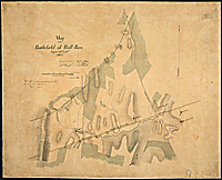
Battle of Bull Run, August 29th and 30th, 1862. (ARC ID: 305590)
What’s there: The holdings of the National Archives and Records Administration (NARA) include more than 2 million maps, many (most?) of which are in the public domain. You can view a sample of the NARA’s map holdings by using the Archival Research Catalog (ARC). Not all the ARC records are linked to digital copies, but it’s easy to find the ones that are by using the basic search function.
For an overview of the collection, see the Guide to Cartographic Records in the National Archives (not a free publication; the cost is $25.00.) Also see Special List No. 29: List of Selected Maps and State Territories, which is available online. You can find instructions on how to order map reproductions here.
Using the maps: NARA’s cartographic holdings include maps produced by various federal departments and agencies, and such works are in the public domain in the US. However, some maps may be copyrighted or subject to donor restrictions. Each map you find will have publication information and use restriction info in its record, so be sure to check.
- National Atlas of the United States®
-
What’s there: Online atlas with customizable, printable maps of every state. You may also print preformatted maps on various topics (formats are GIF and PDF) and purchase wall maps. And if you have desktop mapping or GIS software, you can also download GIS files and make your own maps.
Using the maps: The geographic information is contributed by a number of federal agencies and each issue is produced by staff at the US Geological Survey (USGS), making the National Atlas a public domain work.
Note, though, that National Atlas of the United States® and The National Atlas of the United States of America® are registered trademarks of the Department of the Interior. The site’s legal notice also warns you that some USGS pages contain material that is copyrighted by others (and used by the USGS with permission) and that there may be some non-USGS data, products, and information linked, or referred to, from the site that is protected under US and foreign copyright laws. (You’d need permission to use these materials.) So ... what to do? Just keep your eyes open for any copyright notices or other restrictions.
- National Map Viewer
-
What’s there: Interactive US map viewer that allows you to customize the view and display layers of information (for example, boundaries, elevation, or geographic names). You may also print maps in PDF, or extract vector (line-based) and raster (image-based) data layers, which are downloadable as ZIP-archived data bundles of shapefiles.
Using the maps: The maps are in the public domain. The data comes from federal agencies — the USGS, US Forest Service, US Fish & Wildlife Service, National Oceanic & Atmospheric Administration, and Shuttle Radar Topography Mission (NASA) — and the Montana Natural Resource Information System (which places no use restrictions on the data, except that state law prohibits your use of certain data as a mailing list).
- National Park Service Maps
-
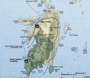
Map of Isle au Haut, Acadia National Park, Maine.
What’s there: Digital versions of the maps found in the official brochures provided to National Park visitors. Maps are available in three formats: Adobe PDF (for browser viewing and printing), Adobe Illustrator (for professional print production), and JPEG shaded relief (topography maps for professional print production). The site includes production tips. Maps published by the National Park Service may also be obtained through individual parks. Contact information for all parks is here — click through to any park(s) you’re interested in and search for “maps” on the park’s home page.
Using the maps: All the maps on this site are in the public domain. Just make sure not to use the National Park Service seal or claim National Park Service endorsement of your use of downloaded maps. Note: You can also find find maps for sale at the National Parks Store, but a number of them are National Geographic maps, which are protected by copyright.
- New York Public Library Digital Gallery | Map Division
-
What’s there: Online gallery including US historical maps, maps of New York, English maps, charts, atlases and gazetteers ... and more. (There are more than 2,000 gallery items in the Map Division.)
Using the maps: Personal, research, and study uses are free. However, even though most (if not all) of the maps are in the public domain, the NYPL site states that “as the physical rights holder of this material ... the Library charges a usage fee if images are to be used in any nonprofit or commercial publication, broadcast, web site, exhibition, promotional material, etc.” The fee schedule is here and the library's permissions terms and conditions are here.
- Perry-Castañeda Library Map Collection | University of Texas
-
What’s there: This library has scanned and put online 5,715 maps (a small part of its collection), including world maps, U.S. maps, polar regions and oceans ... even bird flu maps. There’s a section of historical US maps, too, that includes military history maps. Also maps of national historic sites and memorials. The web site also provides links to tons of maps and map-related sites. You may also submit map questions, and there are research links. The site is a must if you’re seriously researching in this area.
Using the maps: Most of the maps are public domain maps. You may download them and use them as you wish (there are JPEGs and GIFs). The maps that are copyrighted are clearly marked as such. Note: A few maps include the official seal of a US government agency. You may not use these seals in a manner that would give the impression that your use is approved, endorsed, or authorized by the agency.
- US Census Bureau Map Products
-
What’s there: Links to various reference maps and thematic maps. Reference maps include a variety of map types that show the boundaries and names of geographic areas for which the Census Bureau tabulates statistical data. Thematic maps are data maps of a specific subject or for a specific purpose. It appears that they offer GIFs and PDFs (large files) ... and you can also order printed copies by calling the Census Bureau.
Using the maps: The data used to create the maps comes from the Census Bureau, an agency of the US government, and is in the public domain. Therefore any maps you download from this site are in the public domain and you’re free to use them as you choose. The Census Bureau does ask that you cite it as the source of any material you republish, however.
- USDA Forest Service Maps
-
What’s there: You can order forest visitor maps and wilderness (topographic) maps for reasonable prices, but you must print and mail in the order form. There’s not too much in the way of online maps, although you can access a list of forests by state, from which you can also purchase maps. Some maps are also downloadable (depends on the state).
Using the maps: Since Forest Service maps are works of the US government, they’re in the public domain (as long as they were produced by government employees). The closest acknowledgement I could find on the web site was this: “Information presented on the Forest Service website is considered public information and may be distributed or copied. Use of appropriate byline/photo/image credits is requested.”
- United States Geological Survey (USGS)
-
What’s there: Home page of the USGS. This is a great place to start your search for public domain maps. Lots of information, and links to everything you need to help you find what you’re looking for. Click the Maps, Imagery & Publications link and you can easily get to the USGS store.
Using the maps: All USGS-authored or produced data and information are in the US public domain. Note, though, that some of the images, graphics, and photographs on the USGS site were not produced by the USGS and are, therefore, protected by copyright. These materials are generally marked as being copyrighted. So (common sense here) don’t use those materials without permission.
If you use USGS content, they ask that proper credit be given. For example: (Map title) courtesy of the U.S. Geological Survey.
- USGS Library
-
What’s there: Web site of the largest earth sciences library in the world, which holds over 450,000 maps. Four libraries make up the USGS Library system — they’re located in Reston, VA, Denver, CO, Flagstaff, AZ, and Menlo Park, CA. (Just in case you happen to live near one of them. You can also get to their web sites via the USGS Library home page.) The library’s online catalog contains over 325,000 records for materials that have been added to the library since 1975. All USGS publications produced since 1879 are in this catalog ... so you’re certain to find sources of public domain maps here.
Using the maps: All USGS-authored or produced data and information are in the US public domain. Any images, graphics, and photographs on the USGS site that were not produced by the USGS are protected by copyright, however. These materials are generally marked as being copyrighted. Don’t use those materials without permission.
If you use USGS content, they ask that proper credit be given. For example: (Map title) courtesy of the U.S. Geological Survey.
- USGS Store
-
What’s there: USGS products for sale. You may browse the map products by category (for example, limited edition maps), type (map series), or by coverage area. You may also do a geographic search. Searching brings up a map’s catalog record (no image); you may then order the map online. Note: Currently only customers in the United States may submit orders electronically. Those outside the US can the product catalog to identify products and download a PDF order form.
Using the maps: All USGS-authored or produced data and information are in the US public domain. Note, though, that not all information, illustrations, or photographs on the USGS site are public domain. Some images, graphics, and photographs on the USGS site are used by the USGS with permission from the copyright holder (and these things are generally marked as being copyrighted). Don’t use any copyrighted materials without permission.
If you find maps through one of the private dealers ... remember, because USGS works are in the public domain, there are no copyright restrictions on them. Business partners may repackage or enhance the works if they wish ... but they may not claim copyright in the USGS works.
Last, if you use USGS content, they ask that proper credit be given. For example: (Map title) courtesy of the U.S. Geological Survey.
- Yale University Map Collection
-
What’s there: Yale’s map collection is one of the largest university collections in the US, with more than 200,000 map sheets, 3,000 atlases, and 900 reference books. The map collection web site is under reconstruction — the library is currently digitizing some of the collection and making it available online. The format is JPEG 2000. You’ll probably need to download a plugin to view the maps in your browser.
Using the maps: According to Yale Library’s copyright statement, you may use content from the site without permission (except for material in which Yale University Library does not hold the copyright) if you acknowledge Yale University Library in your copy and the copy is used for educational or not-for-profit purposes.
However, the copyright page also includes an acknowledgment that “[a]ny public domain material embedded in this site may, of course, be used without permission.” While an exact digital copy of a public domain map (that is, one that aims to reproduce the map as accurately as possible) arguably does not pass the “minimally creative” test to qualify for its own copyright, Yale University might have a different opinion. Keep that in mind if your intended use is anything but “educational and not-for-profit.”
© www.publicdomainsherpa.com | * legal information is not legal advice *

Except where otherwise noted, the content of this web site is licensed under a Creative Commons License.